Finnmarksvidda is a huge, fairly flat tundra area in northern Norway. At 70 degrees north it is a long way to the Arctic Circle at 66 north. Some years ago I made an attempt to cross Finnmarksvidda in winter with a friend, but bad weather forced us to turn around. That crossing was planned from Alta to Kautokeino. The latter has been called 'the capitol of Finnmarksvidda'. This time I started out in mid August from Lakselv, a small community on an icy fiord off the Arctic Ocean, heading for the elusive Kautokeino.
By Jörgen Johansson
 |
| Getting from Stockholm to Lakselv turned out to be really easy, once I found out there was a direct flight from Stockholm to Tromsö. A couple of hours later a twin prop took an hour to put us into Lakselv. At 1800 hours a taxi had taken me to trailhead. A small path took me up the escarpment you see in the background, to the high plateau of the Finnmarksvidda. |
|
 |
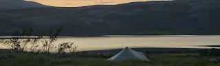
| After a couple of hours of easy walking on springy tundra I pitched my Trailstar near a lake called Stuorra Vuoddojavri. |
 |
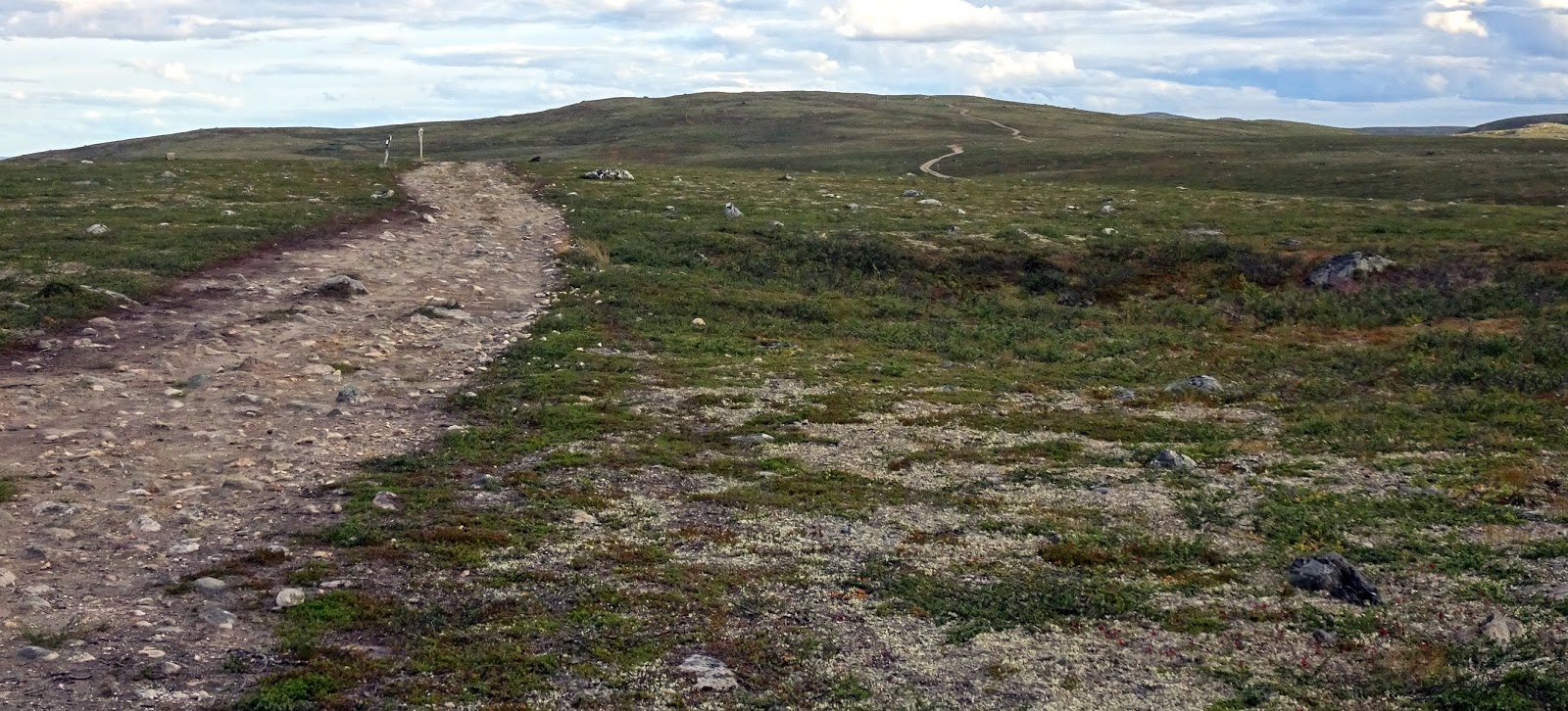
| The beginning was easy walking across a nice, rolling landscape. I followed a quad trail for a while. Quad trails would turn out to be a distinctive part of my walk. |
|
 |
| Following the ravine of Oppdardatjohka I encountered a number of nice, small falls. This day and most of the following days I battled against a strong wind, that at times would unbalance me. Not a storm, but probably close to 20 meters per secund in the gusts. | |
|
 |
| Pretty soon I ran into a type of terrain that would be my company for the next couple of days. A bried summary would be: Rocks. As can be seen from the photo there were precious few places where there was a bit of green, offering some stable footing. In this kind of terrain nothing gives me more comfort, better ankle support, than my walking poles. Contrary to what you might think I also prefer light trailrunners (in this case Salmon Tech Amphibians) to stiff boots. The lightweight shoes makes walking less strenous and makes it easier to plant your feet with precision. |
|
 |
| At the end of the day it started raining and it lasted most of the night. The following day then added the discomfort of not only having to walk on rocks, but on wet rocks. Not extremely slippery, but not like dry rock either. You had to watch your step. |
 |
| The rocks finally gave way to a greener environment and I was further cheered by meeting this moose cow and her calf. |
 |
| Coming down from these broken hills, I aimed for the end of the lake, at the right, when rain hit again and followed me into camp that night by the lake. |
 |
| Getting into a camp wet and hearing the rain drum on the canopy most of the night, nothing makes the world a feel friendlier than waking up to a sunny summer morning. Note the fairly high pitch of the Trailstar. I wanted lots of space inside and the camp was comparatively protected with little wind, as I pitched the tent | . |
 |
| The following days were filled with easy walking, sunshine and slightly decreasing winds in big sky country. |
|
 |
| I passed one place where people lived, at Joatkajavri, although I only heard a dog barking as I walked by and continued along the other side of the lake on a quad trail. |
|
 |
| Quad trails tended to dominate the landscape in a way that quickly became boring. I guess I resent the progress (?) they represent. They are used by people living and working here, mostly the Sami managing their reindeers. I often walked beside them, it was softer on the feet and the walking was easy anyway. Sometimes I walked such a distance from them that I could imagine they did not exist. If I go back to Finnmarksvidda I will probably give them a wide berth since walking anywhere except in the rock gardens is so easy anyway. |
|
 |
| There were a number of these semi-permanent installations along my route, none that were on my maps. They all had to do with reindeer management. | |
|
|
 |
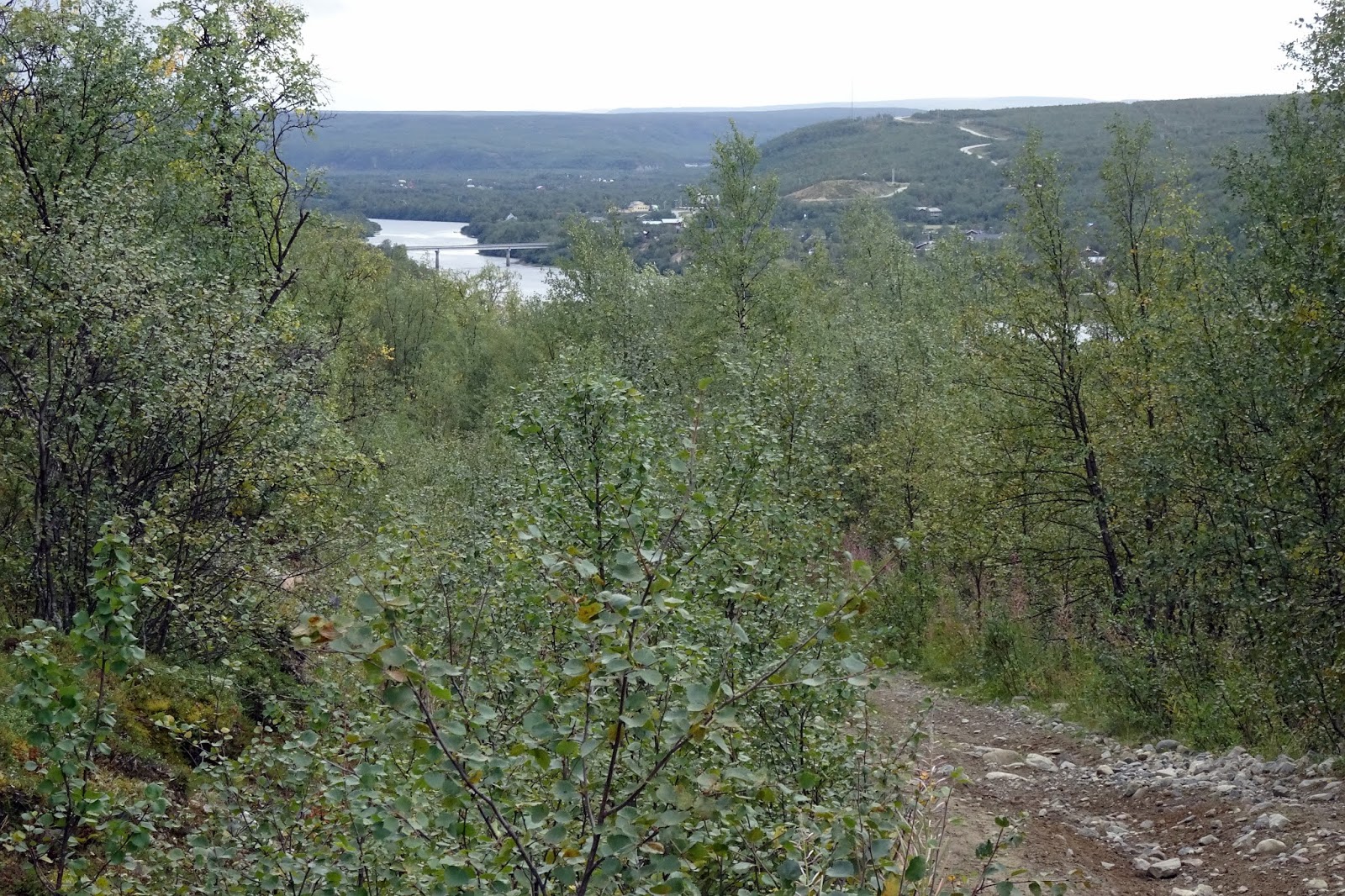
| There are some big rivers on Finnmarksvidda, not really possible to cross without risking your life. The crucial bridge on my route that I had been aming for was at Masi. It also was where I finished my hike. For the first time that I can remember I had gotten a serious cold while hiking. More common is that I have started out hiking with colds that have quickly scrambled back to civilisation. Not so this time. However I spent a couple of enjoyable hours in the combined store and cafe at Masi, waiting for the Kautokeino bus and listening to the locals talking. |
For those interested in my gear: The three big ones where a HMG Porter Pack 4400, a 70-liter pack that weighs one kilo, a Haglöfs LIM Down (460 g), a cell foam pad and an Exped Synmat Hyperlite at 510 grams plus an MLD Trailstar with a homemade inner tent weighing 900 grams.
Pack base weight was about 7,5 kilos and starting out with food for 8 days the pack weighed about 14 kilos as I shouldered it in Lakselv. You can read more about the gear I use in the book series Smarter Backpacking on Amazon (in English) or in Vandra Fjäderlätt (in Swedish).


What a unique wild place, Jörgen. The scenery looks remote and spectacular. This inspires me to come back to Scandinavia and explore the far north.
ReplyDelete